is it possible to export DWG (including text) to KML (google earth file)?
hi.
a customer recently asked me to export a 2D irrigation system design to a kml file.
I know how to export lines & polylines from dwg to kml (with QGIS) but It doesn't allow to export text.
I saw that C3D have a publish tool that create a KML from DWG.
dose any one have an idea on how to do it with bricscad?
thanks,
Ari.
Comments
-
There are solutions out there maybe Dotsoft has something. But there is a fee.
0 -
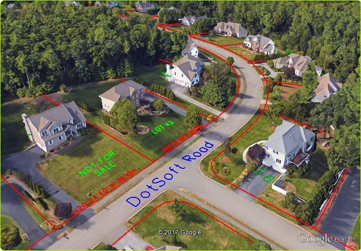
Thanks for the mention ALANH, yes we have a Map Publish tool that projects pretty much all objects into KML/KMZ including text, mtext, etc. This is not a placemark with locked horizontal orientation, it's a font that we draw. The tool is included in our MapWorks for BricsCAD and for those with limited budgets, the low cost GeoLocPlus subset. Here is one graphic example.
 0
0 -
@Terry Dotson
Hi Terry and thanks for the reply (and thanks to @ALANH for rising it up as well).
a few questions about the GeoLocPlus subset:
1. about the text - can I use the dwg font or the GeoLocPlus subset has its own fonts that I must use? the font on your example are some what blurry...
2. is there a tutorial or a guide that I can look on or read?thanks,
Ari.0 -
While we could draw the outline of any Windows Truetype font, the results would be less clear and make the process at least twice as slow. We have our own SIMPLEX 'like' font that we use with a balance of vertices so it reads well zoomed in, but doesn't bog the GE engine down when there are a lot of them. The distortion you see is from GE projecting it onto a 3D view and I believe the raster was been scaled down after. Click on the thumbnail below to see how crisp it actually is.
Email me dotson [at] dotsoft [dot] com and I'll send you the .CHM help file from the GeoLocPlus package.
0

