TIN - crazy contours as results

I made a TIN, based on regular points with 0.5 m distance, on a rather plain natural surface. Entire area 4000m², total difference in height 3 m, set main contours to 1m, sub(?)-contours to 0.25.
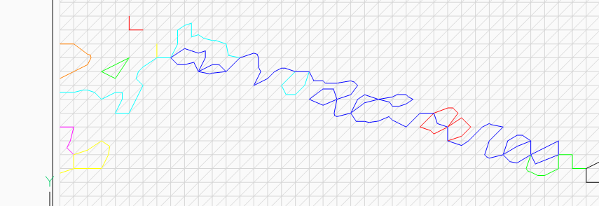
here is the result of 1(?) contour of 437.5 m - a crazy package a fragmented, intersection, non closed , ... polylines. (They are differently coloured for better displayed, the raster in background is 0.5m)
What went wrong here?
Some settings?
I never saw a contour like this ...
here is the result of 1(?) contour of 437.5 m - a crazy package a fragmented, intersection, non closed , ... polylines. (They are differently coloured for better displayed, the raster in background is 0.5m)
What went wrong here?
Some settings?
I never saw a contour like this ...
0
Comments
-
A quick guess but difficult as this looks like cloud data is, reverse the triangle pairs so the 45 line goes the other way. Only way to look at this is for you to post data not surface. But dont want a 200mb cloud.0
-
-
I dont have Bricscad TIN checked in CIV3D looks ok sorry can not help.0
-
Hi Peter2,
could you attach this file here, so we can take a look at it? I created a TIN using your test file and this is the result using Bricscad V22.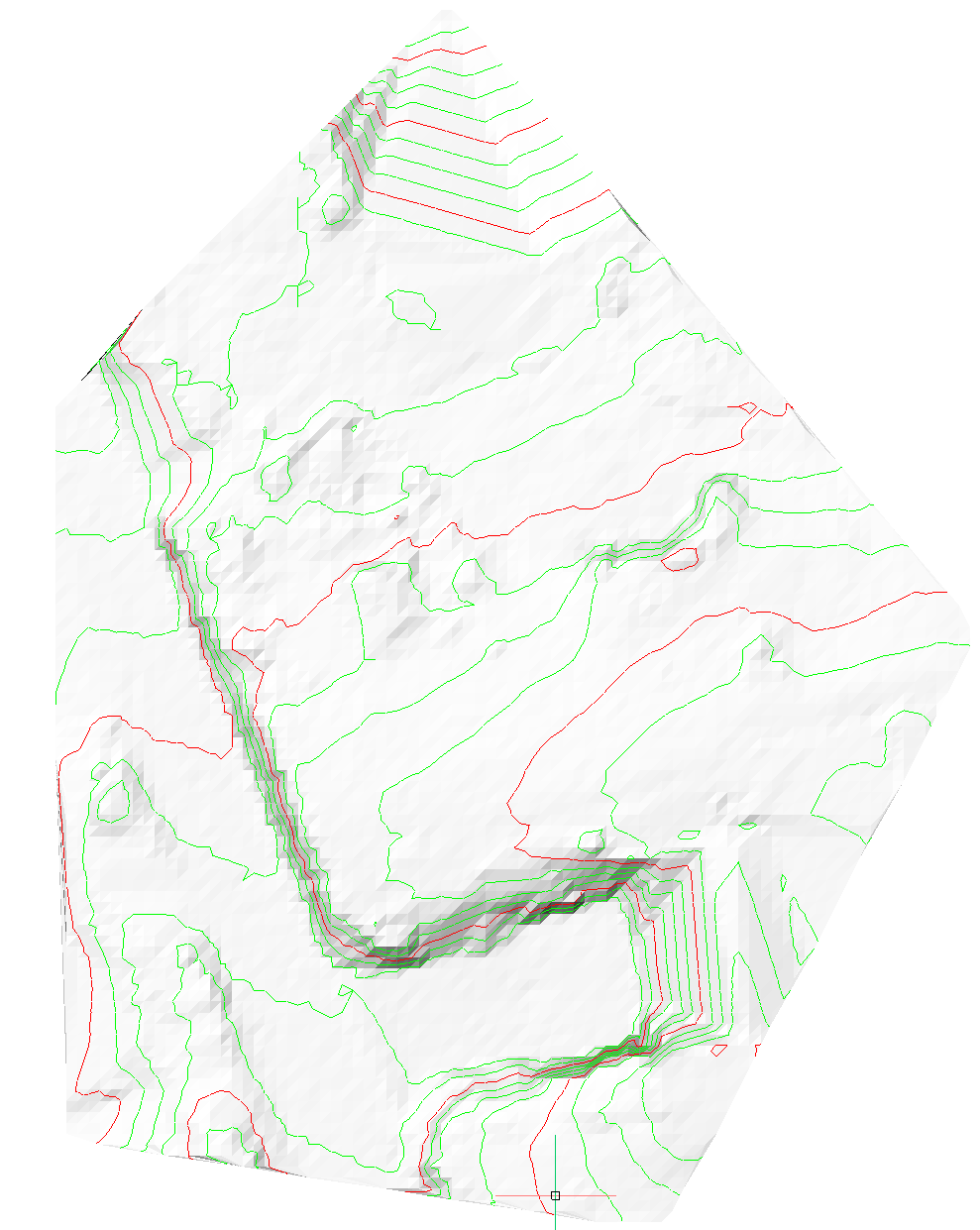
0 -
Here is my tin_test.dwg. Not exactly the same position, but nearby and the same issue. I displayed the contour 427.25 in different colours - dead end lines, flying / lost elements, self crossing contours ...
Maybe that's the result of the exact calculation, but is there no refinement and purging or some error checking?0

