section tools

hello,
As I'm prepared to transit from autocad to brickscad,
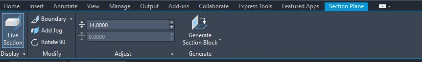
i would like to know if for the section tools is it a possibility to adjust thickness numericaly like it is possible in autocad?
and if a panel display comparable to the autocad one is possible,
thanks in advance,
As I'm prepared to transit from autocad to brickscad,
i would like to know if for the section tools is it a possibility to adjust thickness numericaly like it is possible in autocad?
and if a panel display comparable to the autocad one is possible,
thanks in advance,
0
Comments
-
Hi Hadrien,
For the moment we don't have this same setting. You can control the thickness of a section (boundary or volume) by editing the vertex points in the properties panel. Or you edit the section by dragging the arrows.
We know we can improve here, please create a support request if you want to add more weight to this topic.
Did you try cropsolids? This is a very handy way of showing only a part of the pointcloud.
0 -
Thanks for your answer,
i just find the vertex option, and it's already a lot more easier than by draging the arrow.0 -
As a surveyor by trade in my early days I now find myself drawing up 2D plans from Point clouds I receive from an external party whom I task with the scanning.
Firstly, congrats on integrating point clouds into the software (I'm a Pro license user)
From my first couple of jobs I would say there are 2 things you could look to implement that would massively improve the workflow.
Firstly, as above the ability to specify the slice thickness.
Secondly, if you could then move this slice along an axis using say the page up/down keys it would be a real game changer.
For example a thin horizontal slice through a building and then moving that up and down at will without re-slicing would speed up productivity immensely.0 -
Just-Me, v interesting - I am considering putting effort into learning to make my own As Existing 2D plans sections elevations, from commissioned point cloud, to my own style-spec which is well refined to form the basis of subsequent As Proposed drawings. Presently I waste horrific time in taming Surveyors' sloppy styles of creating 2Ds, when it comes to altering them 'As Proposed'.
So how do you find it, how do you do it? In Brics, or perhaps in Adesk software then imported? In my case, it's a high proportion of old buildings with wobbly surfaces, nothing straight flat perp or square.
I played with doing it all myself, with photogrammetric capture (not requiring expensive lasers) but with little success, unfortunately, as the photorealistic model is fab to have. Still, I can also cut through the PC to create pointiliste raster backdrops to elevations.
0 -
It was a pleasure to excise Autodesk and their subscription model by shifting over to Bricscad which for normal Draughting takes about 2-3 days to switch over to, however you can be productive (just slower) from day one. We are getting a lot more survey requests now so I decided to try with plain BricsCad as it will open many different formats unlike Cloudworx etc. I would say that I was drawing plans within a few days after working out how to do it.
First I couldn't get any point cloud to display but that was because Bricscad was in wireframe mode which doesn't display point clouds so switching display to modelling resolved that one.
Next was enabling point cloud snapping which is off by default.
Then slicing and moving the cloud behind / below Z=0 so what you are drawing is visible.
Locking it's layer stops any silly accidental movement of the cloud.
osnapz ON means that you always draw flat at Z=0 when tracing.
For elevations and sections, change view to suit then set UCS to view and you can then trace away in that direction with a flat result.
If you already have Bricscad (pro and up) then get a point cloud and try it. If you don't, pay the grand and get a copy because at best you'll be on your way to making your own drawings from point clouds, at worst you'll have a decent CAD program.0 -
Thanks - interesting to hear the series of challenges you met in 'learning' PCs in BC's world - a couple there I hadn't thought to do systematically.
You haven't mentioned, but I guess you're cropping the PC e.g. just a whisker above FL, so you see the floor's perimeter, then make the best job you can to trace that line at z=0, osnapz enabled? Is that accurate enough? Do you use BC's plane-detection tools, so the wall planes (some kind of best-average through a bunch of nearly coplanar points) define the floor edge less amiguously where they intersect with the detected floor plane?
I can prob get someone to train me to do this using Acad tools, then a matter of discovering the BC equivalent, which may not be direct tool equivalents but an alternative process.0 -
Where I take a slice is dependant upon what is in the room. If there are cupboards etc. in the way then a low down one won't show the walls. This is the main point for introducing the ability to move a slice as it negates having to make multiple ones. Actually I quite often slice just below the tops of windows and doors in the first instance.
Do I use plane detection, not to my knowledge. I take a thin slice no more than 10cm and snap to it close to corners then fillet rather than trying to pick the exact corner point. how many snaps I place along a given surface is dependent on how uneven it is. I always snap to worst case points too so minimum distances are picked up.
If you have an iPhone 12 or 13 pro with the lidar, you can quickly knock out some .LAS point clouds to play with. Whilst not the most accurate, they allow you to practice the principle of slicing and tracing.
At the end of the day, all 2D drawings feature a level of interpretation on the part of the person Draughting it as it simply can't show all the variations across a face.
Perhaps I'll knock out a quick video for YouTube when I get a moment.0 -
Very interesting - thanks.
Have you come up with a spec to stipulate, for the quality of the PC (density of points or whatever, structured (from scanner) vs unstructured (from drone, AIUI)) needed for this process?
I have a Surveyor's PC handy, will try things out, but when I've played with a slice close to floor (or wall) face, it seems extremely ambiguous - a fuzz really, yet the Surveyor's accompanying 2D plan has numerous spot levels to 1mm specificity (I won't call it accuracy!).0 -
I suggest having a look at cropsolids. As the name suggests, it's a solid geometry that crops pointclouds, very easy to manipulate.Just_Me said:Where I take a slice is dependant upon what is in the room. If there are cupboards etc. in the way then a low down one won't show the walls. This is the main point for introducing the ability to move a slice as it negates having to make multiple ones.
https://www.bricsys.com/en-eu/blog/whats-new-for-point-clouds-in-bricscad-v220 -
But do I have to be in a drawing set up as modelling to use this?omidekrami said:
I suggest having a look at cropsolids. As the name suggests, it's a solid geometry that crops pointclouds, very easy to manipulate.Just_Me said:Where I take a slice is dependant upon what is in the room. If there are cupboards etc. in the way then a low down one won't show the walls. This is the main point for introducing the ability to move a slice as it negates having to make multiple ones.
https://www.bricsys.com/en-eu/blog/whats-new-for-point-clouds-in-bricscad-v22
If so this is of no use to me because I want the tools in the Draughting mode.0