Transparency Slider for Point Clouds

Hi,
I'm a land and building surveyor currently running a trial of Bricscad with a view to migrating from AutoCad.
Most of my current work is small/medium house+topo surveys and I've more or less reduced theodolite work to target control and a few levels then the whole job is scanned with a BLK360 (including topo).
I've been playing with some of my point clouds in Bricscad + the KTF Pointcloud addon.
AutoCad and Bricscad both have - Point Density, Point Size, and Style/Colourmap. I can also control the POINTCLOUDPOINTMAX variable.
My problem is -
In AutoCad there is also a TRANSPARENCY control in the form of a slider that ranges from 0 to 90%. This has multiple benefits - It reduces the speckle effect of the points, fades the cloud so that line work is more visible, and (importantly) reveals and enhances detail below the nearest points eg. detail below shrubbery (especially vertical faces). I use it for everything (generally 1% for topo, 80% for floor plans, 1-25% for elevations)
I can't seem to find an equivalent tool in Bricscad.
I'm fully prepared to alter my methods and workflow but the absence of this tool could be a deal breaker for me...
Any help/advice appreciated (I can attach some comparison screenshots if helpful).
Thanks in advance.
Quentin.
0
Comments
-
Here are some comparison screenshots (Bricscad left, AutoCad right)
Both pointsize minimum (1)
Both POINTCLOUDPOINTMAX maxed out
Both look pretty much identical when AutoCad transparency is 0%
Transparency 80% in AutoCad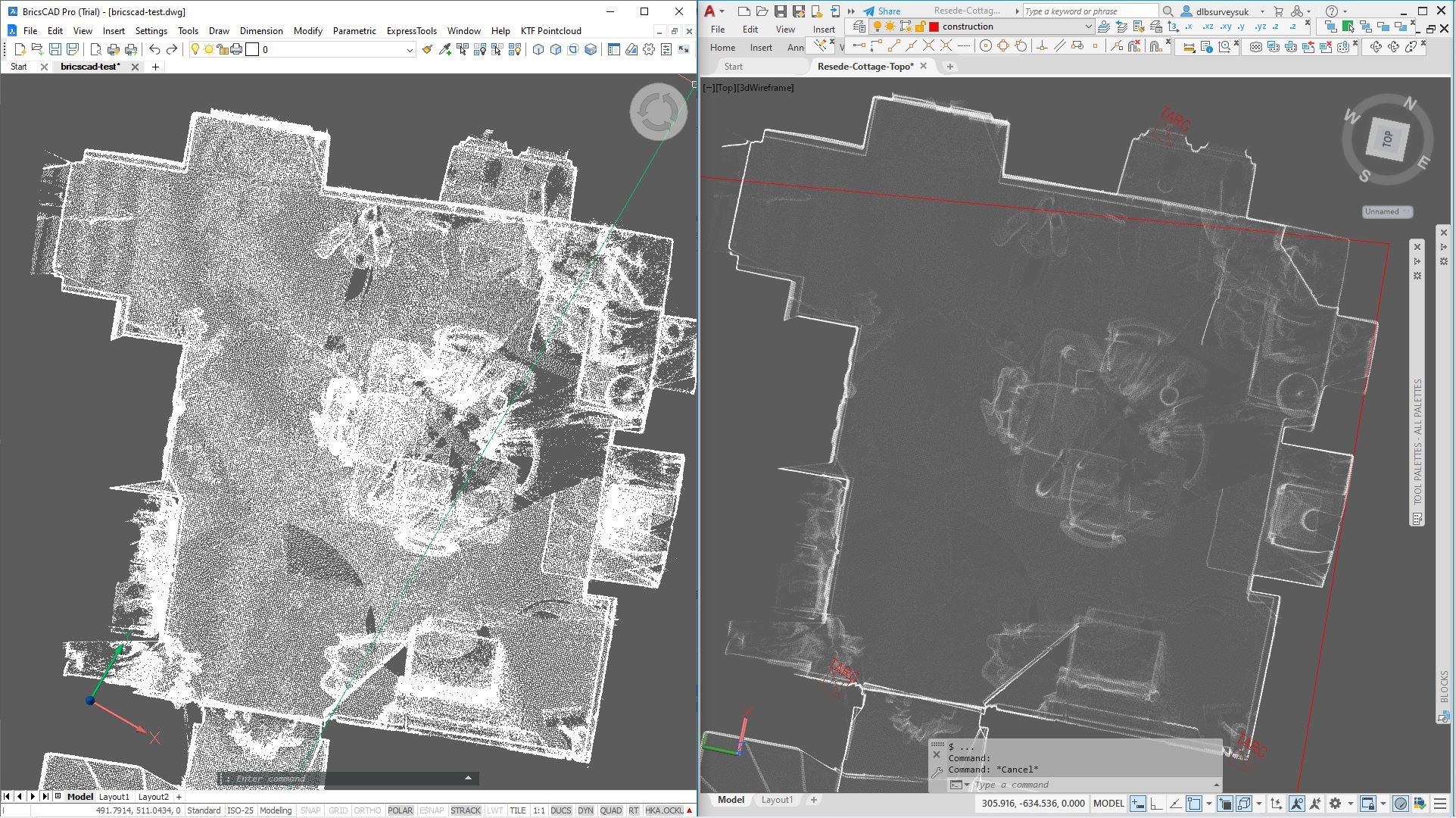
Reduced point density in Bricscad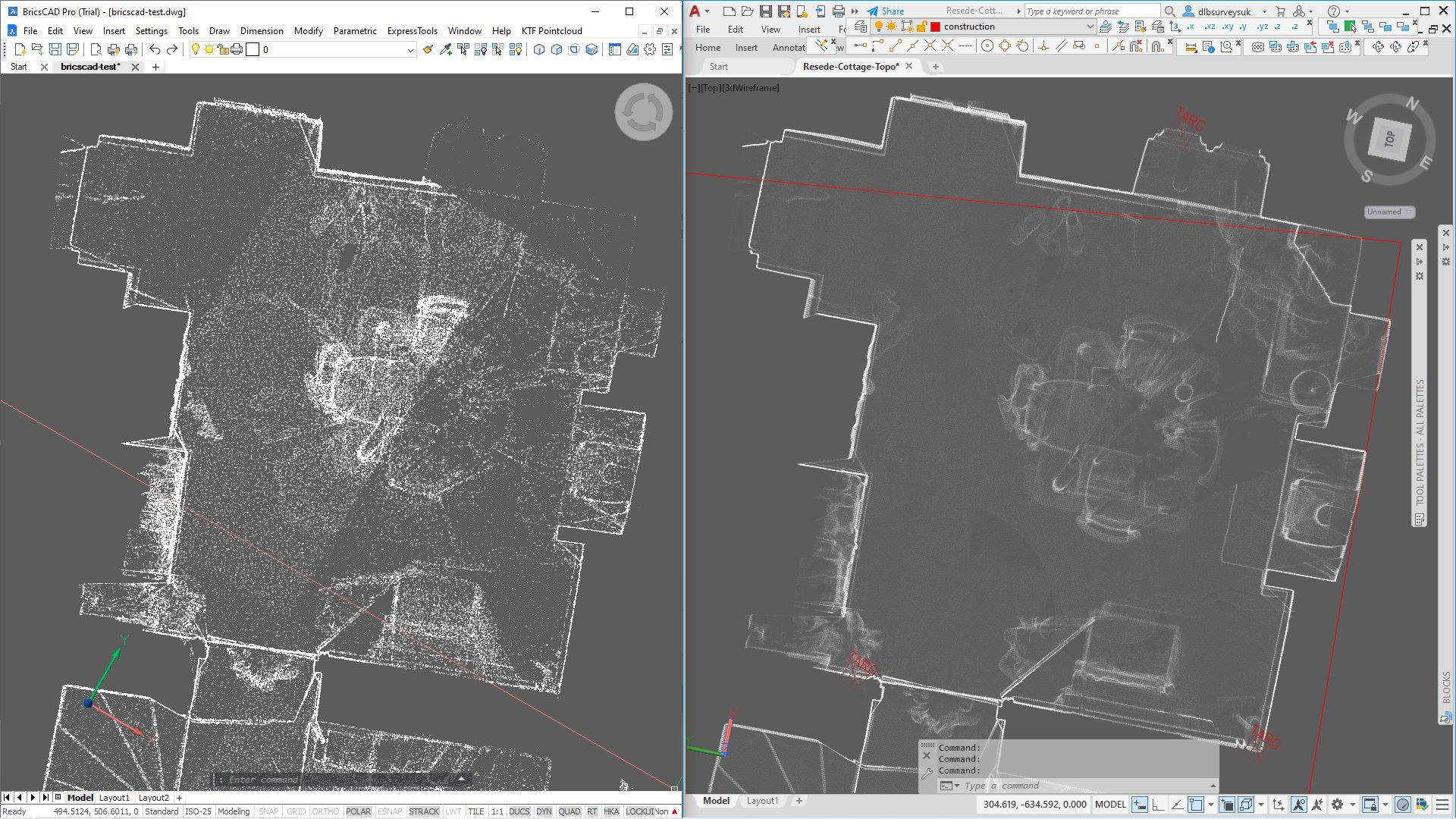
Transparency 1% in AutoCad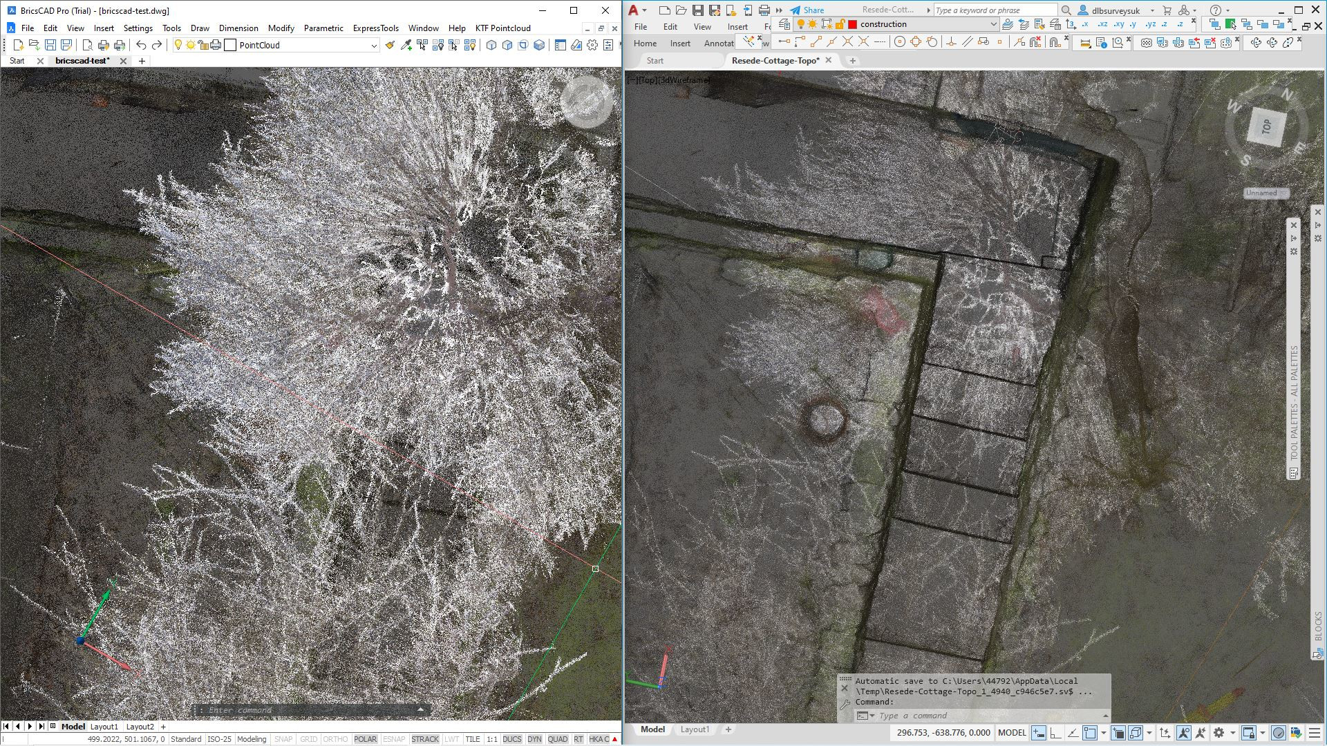
Reduced point density in Bricscad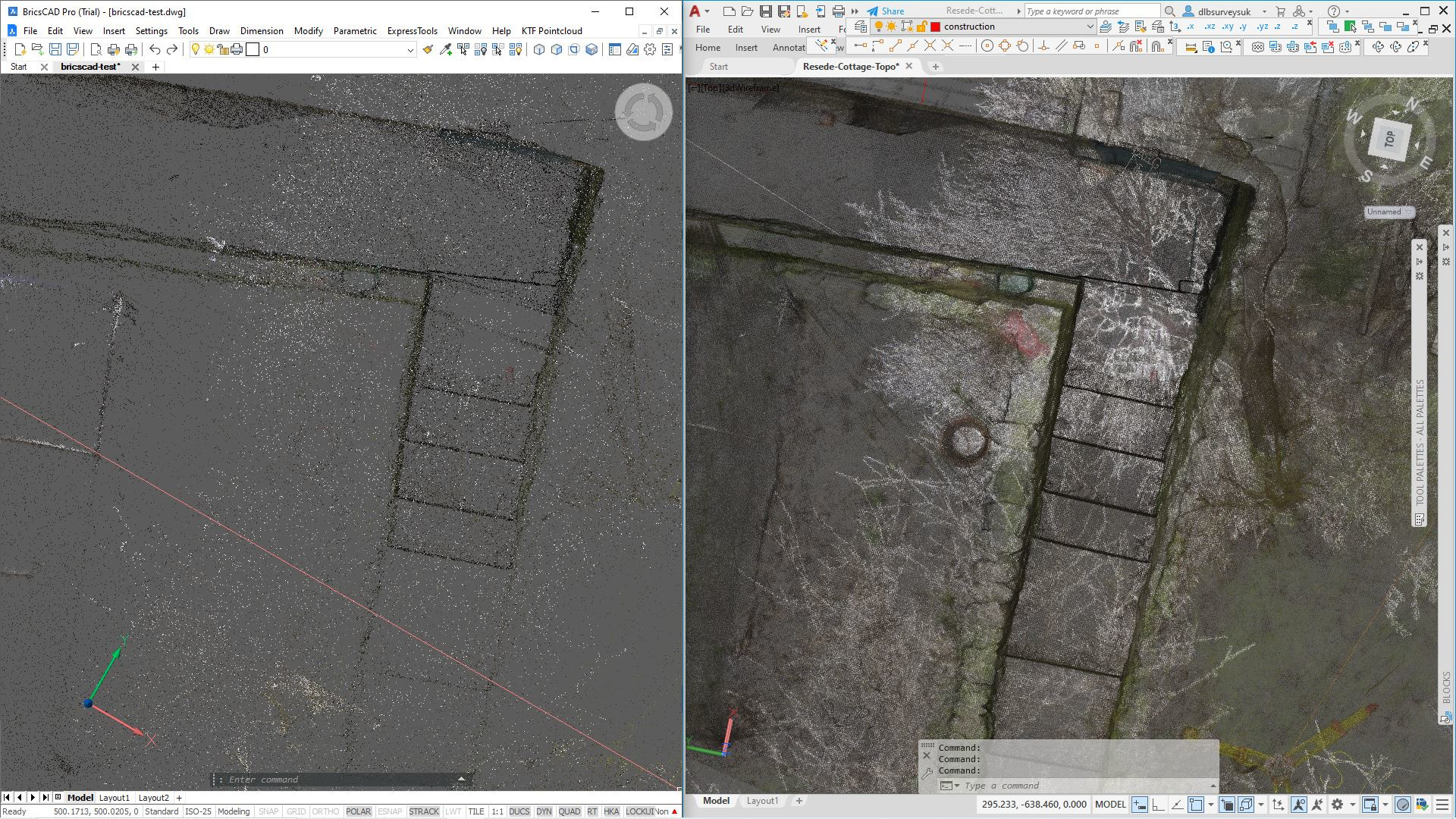
0 -
Also, navigating the point clouds in Bricscad is laggy and I'm getting a tiling effect (visible in the reduced point cloud density floor plan example). Is this maybe a graphics issue?
In AutoCad there is an OBJECT COLOUR option for visualisation, which is how the floor plan point cloud is all white. In Bricscad I had to fiddle about adjusting various settings in the INTENSITY visualisation and it doesn't seem to remember these settings when the program is closed.0 -
I tried to give Layer Transparency, that did not work for me here, V23 on Mac.
Also Adaptive Point size seems to not work as I was used in the past or at all ...
But V23 has some options for Coloring the points but I seem to use it wrong
or it does not work here.0 -
Yes, I randomly tried Layer Transparency in properties to no effect.Michael Mayer said:I tried to give Layer Transparency, that did not work for me here, V23 on Mac.
Also Adaptive Point size seems to not work as I was used in the past or at all ...
But V23 has some options for Coloring the points but I seem to use it wrong
or it does not work here.
I figured out colouring the points with -
Pointcloud Colormap > Color Stylisation >Intensities
Use Gradient > No
Nr Colors > 1
Name > Object
Color > White
Save
This gave me a color scheme called Object with all points white. It doesn't remember this scheme for subsequent sessions though.
I turned off Adaptive Pointsize straight away - it's not useful for me.0 -
Great that it worked for your Color.
The Autocad Commandline stuff is too abstract for me
(Mac user by heart)
I also tried in V22 and found the color appearance stuff in properties.
But I only managed to show it Black, Red, Green or Blue ...
But I like the default Scann Colors.
I really like it.dlbsurveysuk@gmail.com said:I turned off Adaptive Pointsize straight away - it's not useful for me.
No clue why I am not able make it work here in V22 or V23.0 -
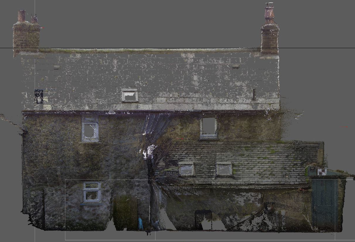
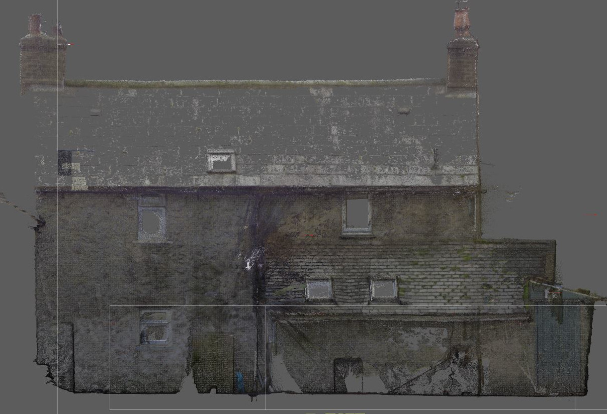
Here's an example of an elevation with non-optimal scan quality, from the same job as above images, surveyed yesterday! First image no transparency. Second image 1% transparency.
0
