Import survey points into Bricscad using CIVILPOINT command

Good Morning,
I struggle to import survey points into Bricscad - see attached file. I'm getting "error parsing line". Can you advise what is the required format of the file and/or what other command I can use to download these points?
I struggle to import survey points into Bricscad - see attached file. I'm getting "error parsing line". Can you advise what is the required format of the file and/or what other command I can use to download these points?
0
Comments
-
I have looked into you file and have interpreted your data as follows :
NAME, EASTING, NORTHING, ELEVATION
Before you import and display survey points, you should configure point file formats, point symbol style and point label style and you do all these things in the Civil Explorer !
Open the Civil Explorer using the CIVILEXPLOREROPEN command.
Then select the Settings View tab .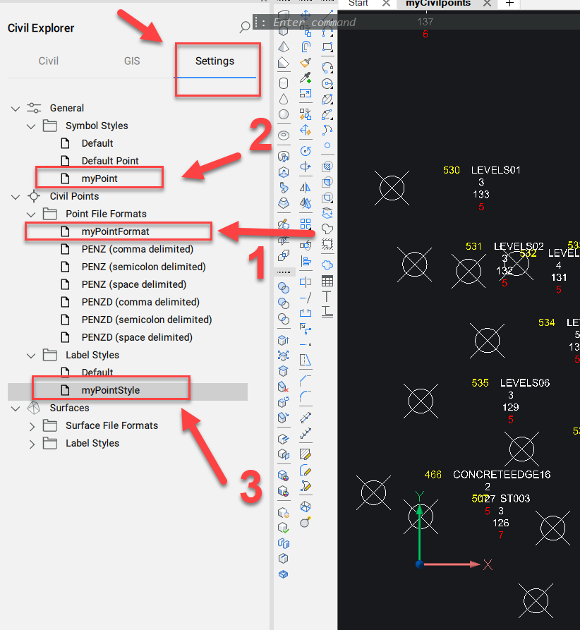
Step 1
You must first configure a new point file format which corresponds to your file structure...
NAME, EASTING, NORTHING, ELEVATION
.......
A1,0.0000,0.0000,0.0000
ST01,6.7714,6.4397,-1.0903
ST02,8.5929,23.7132,-0.8334
ST03,-3.6538,82.3454,1.6770
Right-click on Point file Formats and create your one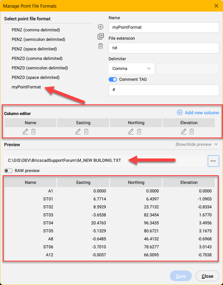
Step 2 and 3
Create now in the same way the point symbol style...(2)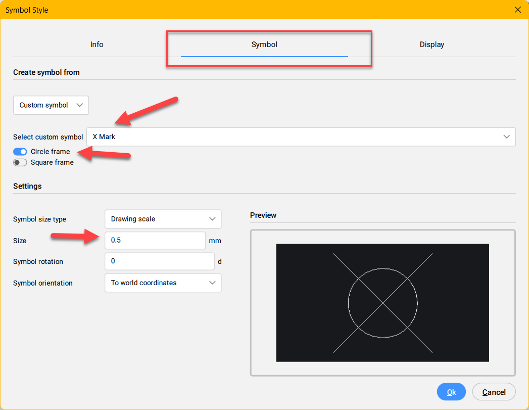
and the point label style (3)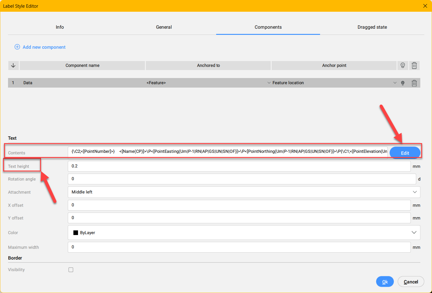
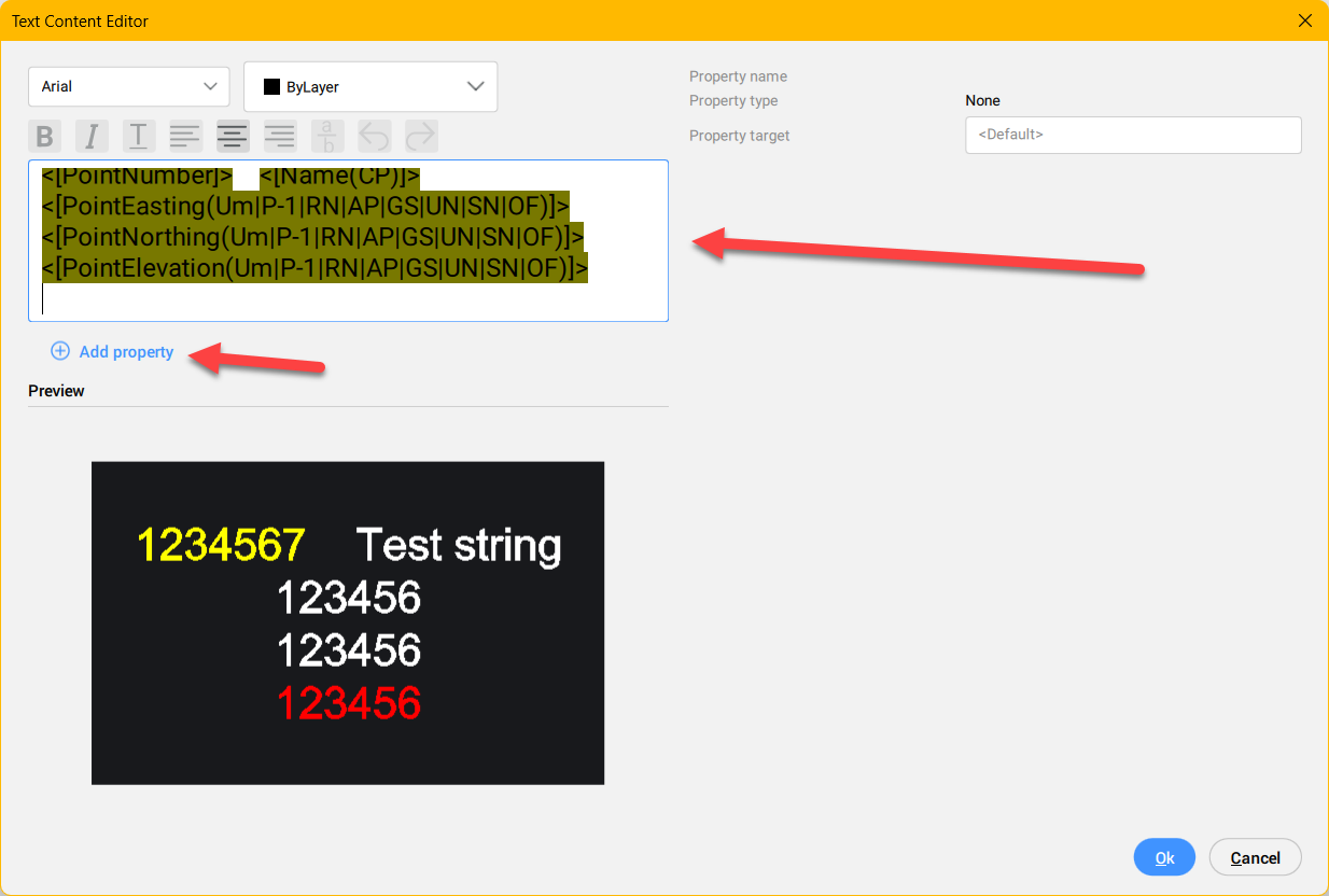
You can now import your points with the CIVILPOINT command,
first set the style myPoint and then import the points from your file !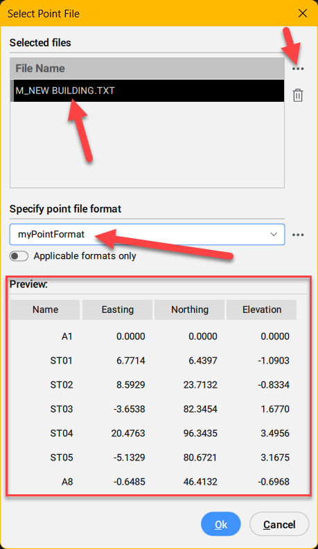
At any time you can change the data in the properties Palette...
you find attached the dwg with all settings and the points !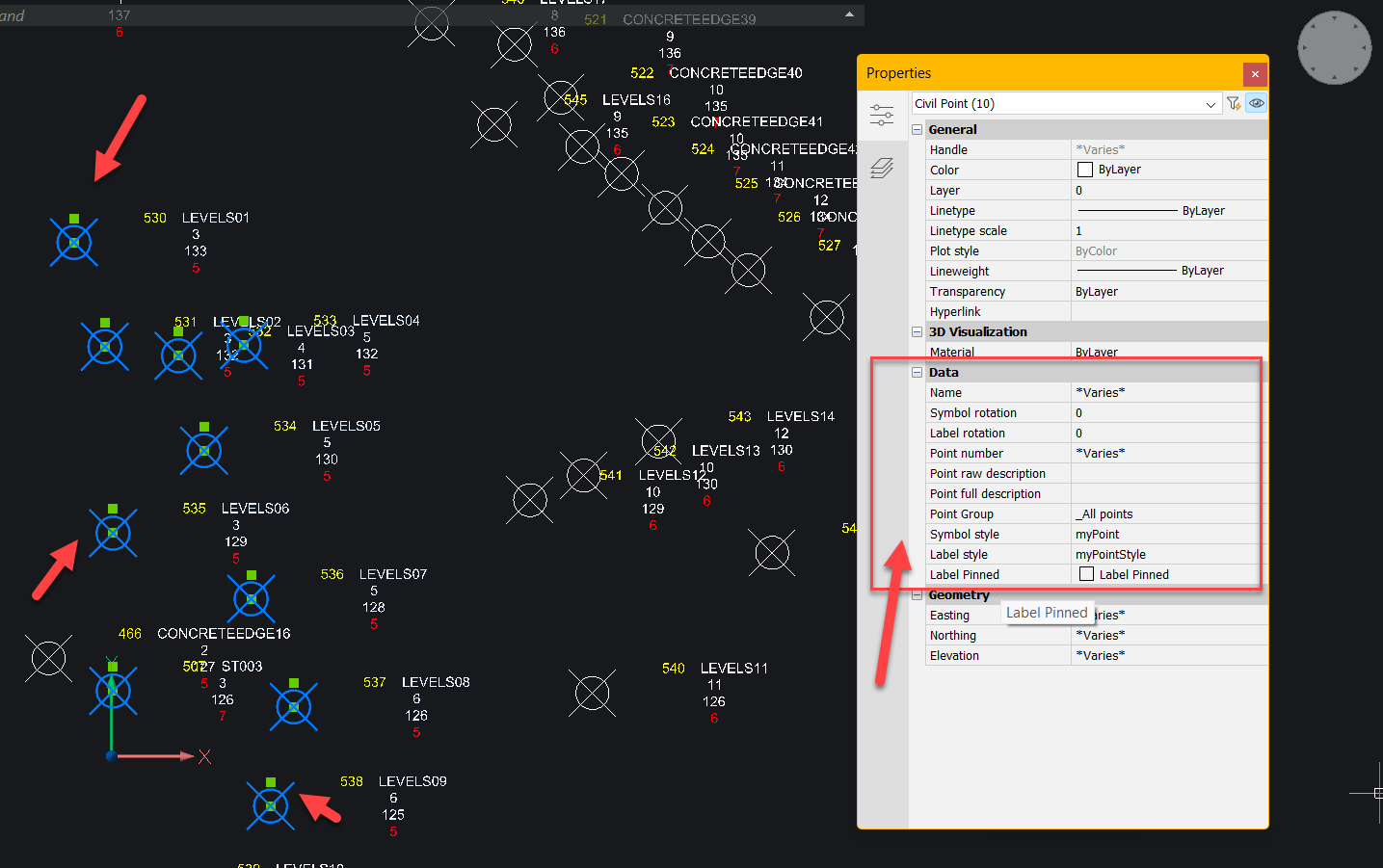
0 -
I fail to understand why one would have to define a new input file format when one already exists - PENZ - for the user's file. I use v24 and have used this way of importing civil points before without a problem. The reason I am here now in this post is that this import no longer works for me. Nothing happens when I hit OK in the select point file dialog - no error, no nothing. What is going on?0
