TIN Surfaces and Gradings Corrupted After Large Coordinate Move — Notes from a New User
As a new BricsCAD user setting up my first civil model, I initially built everything at full UTM‑scale coordinates (in my case, MGA in Australia). That meant the geometry sat hundreds of kilometres from the origin. I soon noticed what I found out to be large‑coordinate issues which apparently is common: snapping felt vague, some commands behaved unpredictably and noticeable Boolean tool errors.
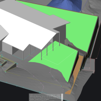
Upon further reading and realising modelling so far from the origin was an issue, I later moved the model back to the origin. This resulted in all TIN surfaces and gradings became corrupted. Some TINs developed long “tails,” others lost faces, and one surface disappeared completely. Several gradings also collapsed or failed to regenerate. Result was to delete all gradings and TINS.
From what I can tell, the problem comes from floating‑point precision loss when civil objects are moved large distances. The triangulation becomes unstable and the surface can’t rebuild correctly.
Recommended work around:
Create 2 files, first one the master file in UTM/MGA (or equivalent national grid)
Second detailed file, build model near the origin.
XREF the detailed model in the second file back into the master
Posting this in case other civil users have seen similar behaviour or have refinements to this workflow. Apologies in advance if this is a known issue, I had read back over recent threads and could not see a relevant discussion.
Comments
-
Thank you for sharing, it can be useful indeed.
0 -
UTM has a false Easting of 500 km to make sure all coordinates within the UTM zone will be positive values, something not everyone using GIS in CAD is aware of.
The workaround described above is one way to solve the problems with a civil model.
A mistake I have seen too often is that people start messing with the origin by putting that close to the model and then not setting it back to the original point (i.e. WCS in BricsCAD) and then complain imports or exports are ending up at the wrong place.
I have rarely experienced issues with models at full UTM scale coordinates set out at UTM coordinates but that also depends on the type of project. My advice to avoid coordinate issues with imports/exports is to put the CRS relative to the internal origin of the CAD program (WCS in DWG) and leave it alone and keep the UCS origin of the DWG file that has the CRS the same as the WCS.
If models have coordinate issues or the CAD becomes slow/unpredictable when working at full coordinates then use the above workaround.
But one should realise there may be projection errors depending on the size of the project because you are working far outside the geographic area of the selected CRS. For e.g. a residential project or a shopping mall this may be virtually negligible but for large scale projects spanning e.g 40-400+ square kilometers this may become an issue depending on the required accuracy.
0