GISEXPORT

evening All
not sure where to post this
I'm trialling latest version and perhaps only reason to upgrade for me is the GISEXPORT option to save as shp or kml files
However I'm having trouble getting this to work.
All my jobs are true GDA2020 Zone 55 and I only work in eastings and northings.
I set the GIS coordinates as GDA2020 EPS:7844 that I gather is the only option for use here from the drop down box.
But the exported file sits either way off over NZ or up north across Indonesia.
Obviously not right.
Any help much appreciated thanks
Comments
-
Thank you for pointing this out! As I see, the problem was reported via SR, reproduced and forwarded to developers.
0 -
Good to know it's being worked on.
thanks for the anticipated fix.
0 -
Sounds like your in AUS like me. Us Aussies need to help each other.
Bigal at Cadtutor forums.
0 -
Yes Tasmania
Interesting use GDA94 and it works okay
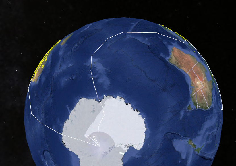
But we work GDA2020 and whilst only about 1.6 difference its differentOne I created spun a spiders web around the globe when opened in Google Earth
I haven't tried shp export. That's no use to send to average person in the street.
0 -
Did you guys get the GDA2020 coordinate system files? I need the same but not sure where to look. Any help will be appreciated.
Thanks mate
0 -
Perhaps ask Lyubov Osina where it's at.
0 -
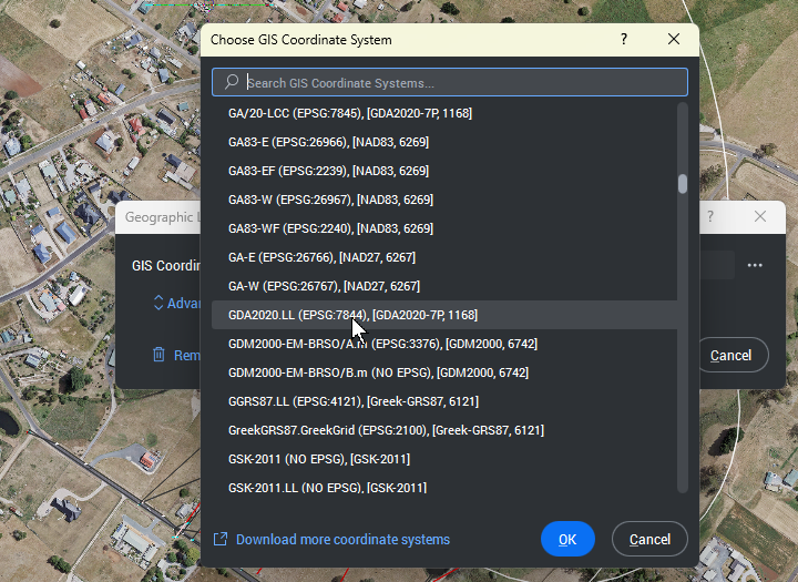
GDA2020 (EPSG:7844) coordinate system is availiable in the default coordinate system list of GEOGRAPHICLOCATION command. CSMAP contains additional GDA2020 coordinate systems, see "About CSMAP" part of this Help article:
0 -
Hi Lyubov,
I am not sure of what I am doing hence my silly question.
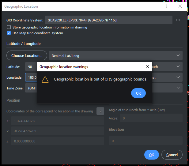
I did find the one you mentioned in the GIS Coordinate System dropdown. But I am not able to progress due to lack of knowledge. I keep getting this message.
Here are the details of what I have to set for my model
Geodetic Datum used : GDA2020
Height Refernce : Australian Height Datum (AHD): RL34.904
Grid Datum : Australian Geodetic Datum (AGD): PM52464
Project Base Point :
N/S: 6951503191.0
E/W: 504671485.4
Elev: -340.0
Rotation: 9.38 deg
Other information that you might need is
Project is located in Toowoomba, Queensland, Australia
Closest city location as per GIS is Brisbane, Australia
Timezone is Brisbane, Australia
Could you please try these values and educate me on how do I apply these to the dialog box above.
Hope this is enough information for you to help me
Regards,
0 -
I've been out of action for a while and now my trial has expired.
Loath to upgrade unless this works as its really the only reason I need, want, to upgrade for. Be nice to know if this is fixed.
0 -
regurgitating this as I'm still interested but trialling the latest it still doesn't export anything meaningful.
Can somone please confirm if GDA2020 exports work. Thanks
0 -
As far as I can see GDA2020 works with BricsCAD V26. There was a quirk in BricsCAD V24 where it would filter the available coordinates based on the previously set long & lat values. The fix was to either:
- Clear the the saved coordinate system, then exit and re-enter the command.
- Pick a city that is located within your desired coordinate system.
The GEOGRAPHICLOCATION command is much more streamlined to use with BricsCAD V26. It is also possible to launch the command by picking it from the status bar.
Jason Bourhill
CAD Concepts Ltd
0 -
Thanks Jason
I exported to KML and got same result. Spiders web all around globe. see attached
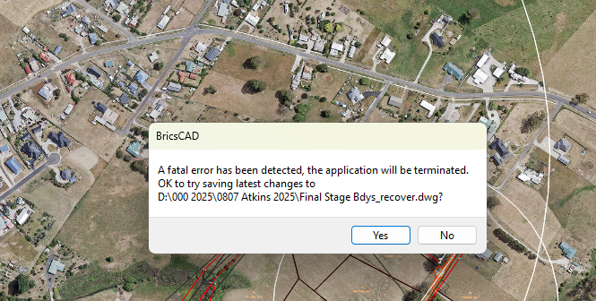
Not sure what caused this in the process earlier
 0
0 -
What units are being used in the dwg file? Meter or other?
What units are set in Google?
This could be a scaling issue due to differences in units.
0 -
metres in dwg. Don't know what Google is, but assume metric. Had it for years and never questioned
Other programs I have work okay and whatever GE is it's the same settings for that.
When I first reported this it works as should if coords set to GDA94.
There's only 1.6± metre shift between 94 and 2020
0 -
I created a KML in Bricscad V27
Put me somewhere off west coast of America
Then did same in my survey software and it put me right where it should be.
Given GE accuracy ie41°27'41.0"S, 146°15'57.5"E
I'm either doing something wrong or there's a bug in the program
Attached is the dwg
True coords - GDA2020 zone 55Oh. can't upload any files
0 -
@Richard Sands I sent you a pm regarding this topic.
0 -
It sounds like there might be a few possibilities:
- There is something in the drawing that does mess up the export (but then one would expect issues with GDA94 CRS as well)
- Something is wrong with the GDA2020 CRS definition in BricsCAD, though I doubt that would be in the EPSG dataset that BricsCAD is using in their geodatabase.xml file unless there was accidental change to that data by whatever cause (e.g. file/data corruption at some point).
- It might be an error in the CSMAP set from Autodesk/AutoCAD if you are using that as well.
- Something is wrong with the GISEXPORT function that happens only with GDA2020 as far as we can tell for now
- Google Earth's import with the GDA2020 CRS is not working properly
0 -
I think the problem here is that GDA2020.LL units are in DEGREES of longitude and latitude. it is NOT in meters. If you've drawn in meters, then you will be approximately 100,000 out, which would lead to unexpected results when exporting.

To work in meters it think you would use GA/20-LCC instead, or one of the MGA definitions.
As an example, attach a couple of drawings of the same location. One in MGA/20-56, the other GDA2020.LL.
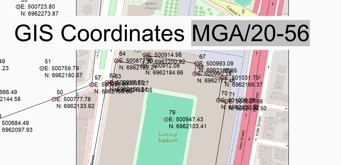
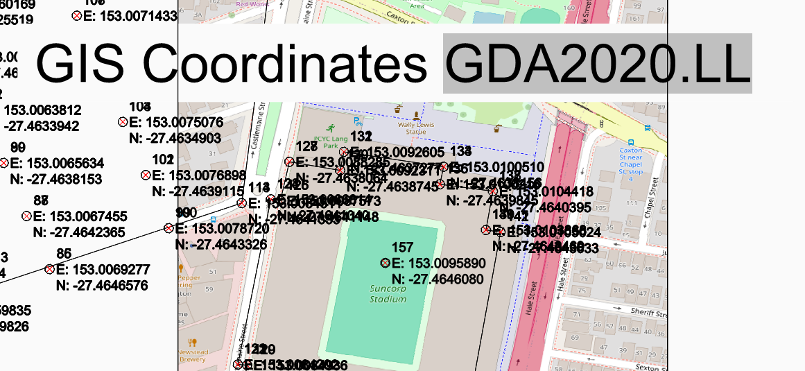
In the case of GDA2020.LL the coordinates correspond to longitude & latitude. e.g. it compares favourably to the location for Suncorp Stadium in
Jason Bourhill
CAD Concepts Ltd
0 -
Something else to be aware of is that KML (Keyhole Markup Language) files store geographic coordinates using the WGS84 standard. When you use GISEXPORT it will switch to export in WGS84 by default.
I included KML files as examples in the previous post.
Jason Bourhill
CAD Concepts Ltd
0 -
Thanks for input and for sticking with this
Now! I automatically assumed, wrongly, that as my dwg originated in another Cad environs that was assigned a GDA2020 coordinate system then that is what Bricscad would adopt.
It seems no. I set the coordinate system to GDA2020 as we just know it at or MGA/20-55….. as Bricscad calls it and all flicked into place as it is supposed to.
User error! Apologies for wasting peoples valuable time.I should have checked if it actually knew what coordinate system it was expecting.
I did wonder why I had to chose such on GIS export but as this is alll new to me in Bricscad I thought it to be normalJason I didn't take any notice of the LL in GDA2020.LL but I expect that means lat/ long 🤔 so no wonder it got its nickers in a knot. Tried to wrap itself around the globe about 3103 times hence my spiders web 🙁
Oh dear!So again thanks. Your input helped me to discover my own ignorance and nonsense!
0 -
There are several CRS that are using degrees instead of meters. Would be interesting to hear of any use cases as like you've found, they aren't a natural fit in the CAD environment!
Jason Bourhill
CAD Concepts Ltd
0